

Satellite firm pauses imagery after revealing Iran’s attacks on US bases
arstechnica.com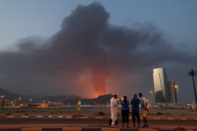
Foreign workers watch as a tall plume of black smoke ascends following an explosion in the Fujairah industrial zone in the United Arab Emirates on March 3, 2026. Credit: Fadel Senna/AFP via Getty Images
Planet Labs, one of the world’s leading commercial satellite imaging companies, said Friday it is placing a hold on releasing imagery of some parts of the Middle East as a regional war enters its second week.
The company, which brands itself as Planet, operates a fleet of several hundred Earth-imaging satellites designed to record views of every landmass on Earth at least once per day. Its customers include think tanks, NGOs, academic institutions, news media, and commercial users in the agriculture, forestry, and energy industries, among others.
Planet also holds lucrative contracts selling overhead imagery to the US military and US government intelligence agencies.
“In response to the conflict in the Middle East, Planet ...
Copyright of this story solely belongs to arstechnica.com . To see the full text click HERE